Early Chicago › Monuments
Early Chicago monuments: I
From Early Chicago, an encyclopedic history of Chicago and its people before 1835, by Ulrich Danckers and Jane Meredith, with John F. Swenson.
History · Chronology · Encyclopedia · Essays · Monuments · Maps · Bibliography · About the authors
A B C D E F G H I J K L M N O P Q R S T U V W X Y Z
Illinois & Michigan Canal National Heritage Corridor - though construction of the Illinois & Michigan Canal did not begin until 1836 and was not finished until 1848, the anticipation of this undertaking began to stimulate the growth of Chicago as early as 1832, so much so that by 1837 the modest village had become a city. What remains today of the canal is carefully preserved by Illinois State effort, and is made accessible to the public by publicized canoe routes, hiking and horse trails, and campgrounds. The various portions of the canal extend from Chicago to Peru, IL. For information and brochures, call the Joliet office of The Heritage Corridor at 1-800-926-2262.Illinois Centennial Monument [1] - 1918 · ornamental Tennessee marble column topped by an eagle at the intersection of Logan Boulevard and Kedzie Avenue; erected by the B.F. Ferguson Monument Fund to celebrate the centennial of Illinois statehood. Architect: Henry Bacon; sculptor: Evelyn Beatrice Longman Batchelder. [Photograph by Alan Gornik, 2010]

Illinois State Line Marker - 1822 · believed to be the oldest historical monument in Chicagoland—a tall, plain, but harmonious limestone structure with multiple fossils (crinoids?) weathering out on its surface, located where the northwest corner of Indiana touches the eastern border of Illinois. To state that this is the intersection of State Line Road and 103rd Street is correct, except that both streets are interrupted near this point by industrial and railroad developments. The visitor must approach from the north to find the monument in the small Allen J. Benson Park at the entrance to the Commonwealth Edison State Line generating plant. Bronze plaques explain that the "State Line was retraced by Act of Congress 1833" and that the marker is now located 191.09 feet north of its original site, and 159.359 miles due north from the Wabash River. [Photo compliments of Alan Gornik, 2006]

Indian Alarm [2] - shown here is "The Corn Dance," representing one of the four incised granite tablets at the base of the above bronze sculpture. The sculptor`s benefactor was Martin Ryerson (1818-1887), who spent several years trading with the Indians in Michigan. Thus the inscription on the base reads: "To the Ottawa Nation of Indians, my Early Friends." Ryerson established a lumber business and came to Chicago, where he had several office buildings built in the Loop. This 2008 photograph and the Ryerson information were provided by Alan Gornik.

Indian artifacts and culture - see Mitchell Museum of the American Indian; see Forest Park Library.
Indian Boundary Lines - 1937 · bronze plaque on Rogers Avenue, northeast corner with Clark Street, inscribed: "Indian Boundary Lines - Clark Street honors George Rogers Clark, whose brother William Clark, with Ninian Edwards and Auguste Chouteau, in 1816 negotiated Indian treaty ceding land including Chicago site from Rogers Avenue to Lake Calumet. - Erected by Chicago`s Charter Jubilee - Authenticated by Chicago Historical Society - 1937." The plaque commemorates the successful efforts of Gov. Ninian Edwards and others to negotiate with local Indian tribes, at the 1816 Treaty of St. Louis, the acquisition by the United States of a tract of land, 20 by 70 miles, that extended from Lake Michigan to the Illinois River near Ottawa and included Chicago, the portage, and the area for which construction of a canal between the Great Lakes and the Mississippi River system was contemplated. Rogers Avenue now forms part of the northern boundary of this tract; Indian Boundary Road southwest of Plainfield also follows this northern line.

Indian Cemetery - see Robinson grave site.


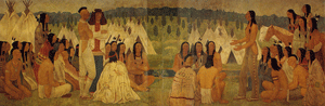
Indian Lookout - 1933 · "Lookout Point - Used as a Signal Station on Main Highway of Indian Travel - Marked by Dewalt Mechlin Chapter - Daughters of the American Revolution - June 14, 1933." [text in preparation]

Indian Signal of Peace - 1890 · bronze statue of Sioux chief on horseback, giving the Indian peace sign; exhibited at the 1893 World Columbian Exhibition, then placed on a high granite pedestal in Lincoln Park, north of the entrance to Diversey Harbor. Sculptor: Cyrus Edwin Dallin. Photographed in 2008 by Alan Gornik.

Indian silver - see Forest Park Library.Indian Sun Vow - 1898 · The Sun Vow bronze sculpture [cast in 1901] of a seated elder Indian observing a young archer releasing an arrow aimed at the sun; exhibited at The Art Institute of Chicago until defaced; now restored and exhibited in The Field-McCormick Galleries of American Arts, Rice Building, AIC. Sculptor: Hermon Atkins MacNeil. Photograph taken by Jane Meredith.


Indians Warriors [1] - 1928 · two bronze statues of Indians on horseback, flanking Congress Expressway where it enters Grant [now Millennium] Park, one referred to as the Bowman, the other as the Spearman, both holding imaginary weapons; each are 17 feet high. The sculptures were created by Ivan Mestrovic. Shown here is the Bowman.
Indians Warriors [2] - the Spearman.

Isle a la Cache Museum - an island in the Des Plaines River near Romeoville, IL, reached from Chicago via the Chicago Portage in one day`s canoe travel on the way toward the Illinois River settlements, was already known to the earliest French traders in the days of Father Marquette`s second exploration to Illinois in 1674. They used the island as a campsite and to temporarily hide their valuable trade goods. The Forest Preserve District of Will County now maintains a small museum there that presents the cultural history of the Indian and French fur trade era. It is located at 501 E Romeo Road in Romeoville; call (815) 886-1467.
History · Chronology · Encyclopedia · Essays · Monuments · Maps · Bibliography · About the authors